Vr Mapping |
ON-LINE REFERENCE DOCUMENTATION CARDINAL SYSTEMS, LLC |
Round Elevations (RouEle)
Type: Batch Application
Rounds the elevations of entities to an even multiple of a user-defined value.
Detailed Description
Round Elevations rounds the elevation of the lines in the specified layers to the nearest user-defined value. Layers and modes that are turned off will not be considered even if specified. The rounded elevation that repeats itself at least 50% on a line will be used for the whole line. If no rounded elevation repeats itself at least 50% then the line will not be modified. This is intended to remove contour lines with elevation spikes.
WARNING: This is intended for contours and should not be run on layers containing planimetric features.
Available Key-ins
Key-in |
Description |
Range |
PARFIL= |
Load parameter file |
Round Elevations parameter file name (.roe) |
RUN |
Run Line Cross |
|
Parameters for Round Elevations
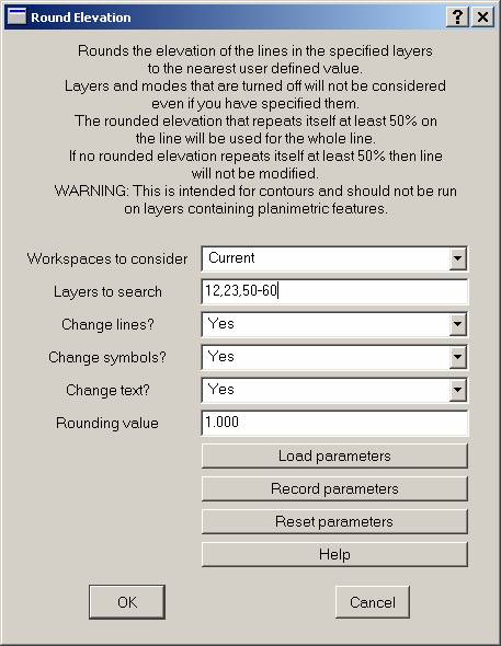
Workspaces to consider
Defines the workspaces to consider when running Round Elevations.
Layers to search
Defines the layers to search for entities to round. Layers that are turned off will not be considered even if they are specified as a search layer.
Change lines?
Specifies whether lines within the search layers should be rounded.
Change symbols?
Specifies whether symbols within the search layers should be rounded.
Change text?
Specifies whether text within the search layers should be rounded.
Rounding value
Rounds entity elevations to an even multiple of this parameter. The rounding value is entered in ground units.